
 Google maps has reached Australia.
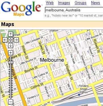
Love them draggable maps. Seems reasonably accurate. There’s some interesting errors, for instance there are Melbourne Tennis Centre access roads shown (which is right) overlapping old rail lines (removed years ago).
For every day use not as detailed as Melway/Ausway (no public transport routes or house numbers marked, for instance, many points of interest missing, such as sports venues) but if you zoom right down, it does intriguingly include property borders. Hey, I can see my house from here.
Alas, the satellite maps for most of Melbourne are still pretty fuzzy.
What an intrigueing mix of information and inaccuracy. For example, Dave’s street (which is a reasonably new housing estate) is shown, but the street I live on, which is broken by parkland in the middle for a good couple of hundred meters is shown as contiguous.
Pretty cool though.
Yeah, must be a mix of data. The road/street and property data seems to be reasonably recent, eg it’s got the recentish A/B/C road numbering scheme, and the Docklands road extensions. The data showing other features like parks and railway lines is less so, eg missing the Puffing Billy railway extension to Gembrook, which (re)opened in 1998.
It’s got no tram lines, except where they are off-road. And it’s not so crash-hot in searching for suburb names.